| |
|
Maps currently valid are highlighted in blue.
|
Map |
Full name of a map (link to version of map valid in that period of time) |
Valid from date |
Valid to date |
Details |
|
Map 1 |
12/12/1990 |
Current |
Introduction |
|
|
Map 2
|
Hauraki - Great Barrier - Bay of Plenty scallop Statistical Area |
12/12/1990 |
Current |
Introduction |
|
Map 3
|
Nelson - Marlborough Scallop and Dredge Oyster Statistical Area | 12/12/1990 | 1/08/1993 | Introduction |
|
Map 3
|
Nelson - Marlborough Scallop and Dredge Oyster Statistical Area |
1/08/1993 |
Current |
Change of the name and definition of areas |
|
Map 4 |
12/12/1990 |
9/10/1991 |
Introduction |
|
|
Map 4 |
9/10/1991 |
Current |
Correction of spelling mistakes |
|
|
Map 5 |
12/12/1990 |
Current |
Introduction |
|
|
Map 6 |
12/12/1990 |
Current |
Introduction |
|
| Map 6 | Area descriptions for Map 6 (Word document) |
12/12/1990 |
Current |
Introduction |
|
Map 7 |
25/02/1991 |
Current |
Introduction |
|
|
Map 8 |
25/02/1991 |
14/07/2000 |
Introduction |
|
|
Map 8 |
14/07/2000 |
Current |
Change of the name and definition of areas |
|
| Map 8 | Area descriptions for Map 8 (pdf file) |
14/07/2000 |
Current |
|
|
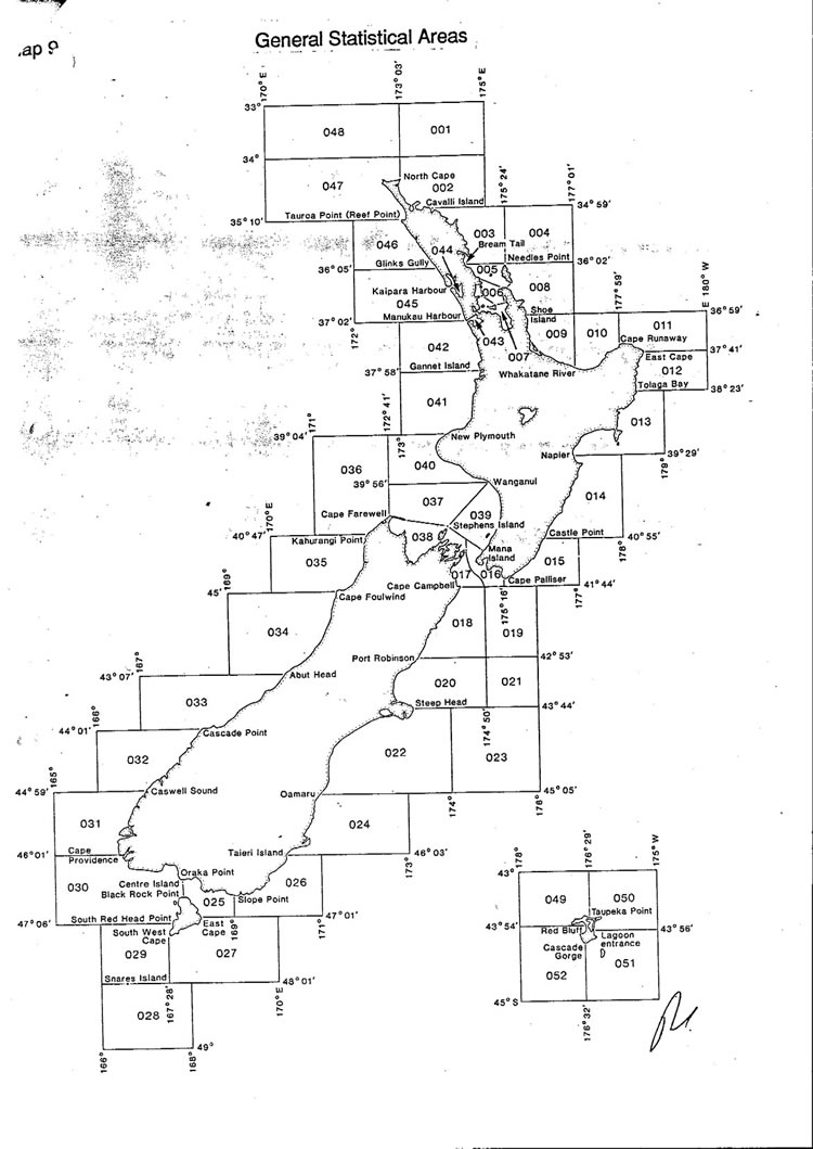
Map 9 |
12/12/1990 |
2/10/1999 |
Introduction |
|
| Map 9 | General Statistical Areas | 2/10/1999 | 25/03/2000 | Insert of Auckland Area |
|
Map 9 |
25/03/2000 |
Current |
Correction of errors discovered after sending previous version to fishers |
|
|
Map 10 |
11/04/1995 |
Current |
Introduction |
|
|
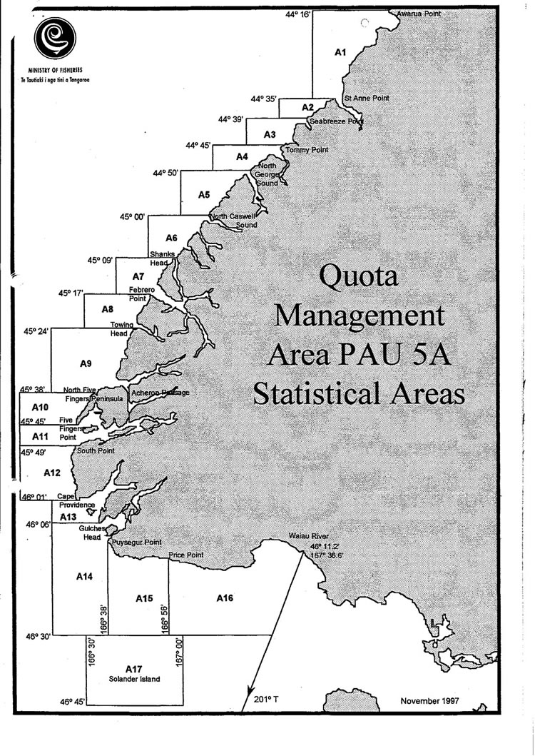
PAU5A |
1/11/1997 |
1/10/2001 |
Introduction |
|
|
PAU5A |
Quota Management Area PAU5A Statistical Areas |
1/10/2001 |
Current |
See Maps: 11g, 11h, 11i |
|
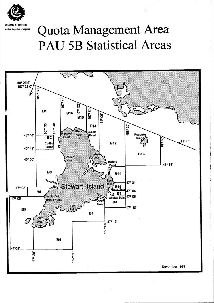
PAU5B |
1/11/1997 |
1/01/1998 |
Introduction |
|
|
PAU5B |
1/01/1998 |
1/10/2001 |
Change of boundaries of areas B3 and B4 |
|
|
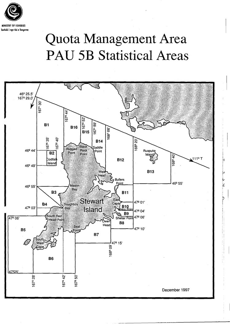
PAU5B |
Quota Management Area PAU5B Statistical Areas |
1/10/2001 |
Current |
See Maps: 11k, 11m |
|
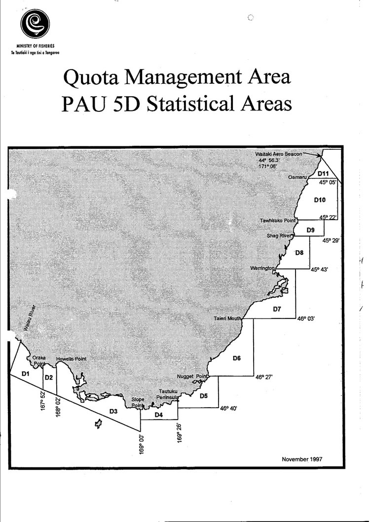
PAU5D |
1/11/1997 |
1/10/2001 |
Introduction |
|
|
PAU5D |
Quota Management Area PAU5D Statistical Areas |
1/10/2001 |
Current |
See Maps: 11n, 11p |
|
Map 11 |
1/10/2001 |
Current |
Introduction |
|
|
Map 11a and 11b |
1/10/2001 |
Current |
Introduction |
|
|
Map 11a |
1/10/2001 |
Current |
Introduction |
|
|
Map 11b |
1/10/2001 |
Current |
Introduction |
|
|
Map 11c and 11d |
1/10/2001 |
Current |
Introduction |
|
|
Map 11c |
1/10/2001 |
Current |
Introduction |
|
|
Map 11d |
1/10/2001 |
Current |
Introduction |
|
|
Map 11e and 11f |
Key to zones in PAU4 – Map 11e and 11f (Word document) |
1/10/2001 |
Current |
Introduction |
|
Map 11e |
Paua statistical areas – PAU4 Chatham Island (PDF format) |
1/10/2001 |
Current |
Introduction |
|
Map 11f |
1/10/2001 |
Current |
Introduction |
|
|
Map11g to 11j |
1/10/2001 |
Current |
Introduction |
|
|
Map 11g |
1/10/2001 |
Current |
Introduction |
|
|
Map 11h |
1/10/2001 |
Current |
Introduction |
|
|
Map 11i and Map 11j |
1/10/2001 |
Current |
Introduction |
|
|
Map 11k and 11m |
Key to zones in PAU5B – Maps 11k and 11m (Word document) |
1/10/2001 |
Current |
Introduction |
|
Map 11k |
1/10/2001 |
Current |
Introduction |
|
|
Map 11m |
1/10/2001 |
Current |
Introduction |
|
|
Maps 11n and 11p |
Key to zones in PAU5D – Maps 11n and 11p (Word document) |
1/10/2001 |
Current |
Introduction |
|
Map 11n |
1/10/2001 |
Current |
Introduction |
|
|
Map 11p |
1/10/2001 |
Current |
Introduction |
|
|
Map 11q to 11v |
Key to zones in PAU7 – Maps 11q to 11v (Word document) |
1/10/2001 |
Current |
Introduction |
|
Map 11q And Map 11r |
1/10/2001 |
Current |
Introduction |
|
|
Map 11s |
1/10/2001 |
Current |
Introduction |
|
|
Map 11t |
1/10/2001 |
Current |
Introduction |
|
|
Map 11u |
1/10/2001 |
Current |
Introduction |
|
|
Map 11v |
1/10/2001 |
Current |
Introduction |
| |
|